Kythira
Kythira
Strategically located between the Ionian, Aegean, and Cretan Seas, Kythira is an island full of surprises, natural beauty, and cultural influences. With an area of approximately 280 square kilometers — comparable to that of Paros or Malta — the island is ideal for easy exploration by car, scooter, or even bicycle.
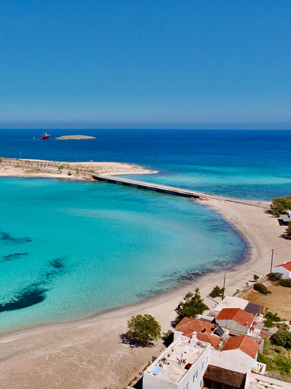
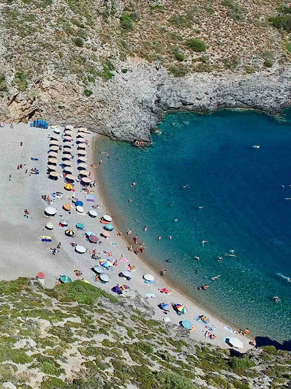
Kythira is not your typical tourist destination. It preserves the authenticity and charm of the “other Greece,” offering a mild climate, abundant sunshine, and diverse landscapes: lush gorges, dramatic capes, secluded coves, and quaint villages with Venetian or neoclassical touches.
This “in-between world” carries Greek, Italian, and French influences, creating a unique atmosphere of relaxation, romance, and reflection. Kythira is an island that inspires — and is often referenced in works of art, literature, and poetry.
Margarita Hotel is the perfect base from which to discover Kythira. From here, your journey into the island’s authentic beauty and historic heart begins.

A Short History
Kythira has a long and rich history as a crossroads of civilizations. Since the 3rd millennium BC, it was a Minoan colony, and in antiquity it was considered the island of Aphrodite.
Over the centuries, it came under the rule of the Byzantines, the lords of Monemvasia, and most notably the Venetians (13th–18th centuries), who left a strong mark on its architecture and defensive structures, founding fortresses such as those in Chora, Paliochora, and Avlemonas.
In 1797, the island briefly came under French and Russo-Turkish control, and from 1812 to 1864 it was part of the Ionian State under British protection. In 1864, Kythira was finally united with the modern Greek state.

Tours / Attractions
Kythira, an island brimming with culture, nature, and serenity, offers a captivating experience for every traveler. Here's a curated list of its most notable attractions:
Melidoni
Limnaria
Vroulea
Fyri Ammos
Kombonada
Limion (Mylopotamos)
Diakofti
Paleopoli
Paleopolo-Limni
Avlemonas (nicknamed the 'Bath of Aphrodite ")
Kalada
Aghia Pelagia
Platia Ammos
Mylopotamos (Kato Chora)
Avlemonas
Palaiochora (Agios Dimitrios)
Monastery Panagia Myrtidiotissa
Monastery Panagia Orfana
Monastery of Aghia Moni
Monastery Osios Theodoros (Venerable Theodore) Potamos
Monastery of Aghios Ioannis Engremmos Kapsali
Church of Agia Anna, Chora (seventeenth century)
Church of Aghios Dimitrios (thirteenth century) - Village of Gerakianika: Surprisingly irregular architecture, has four chapels inside
Chapel Aghia Sophia (Kalamos)
Church of Aghios Charalambos, Mylopotamos
Church of Agios Theodoros, Potamos
Church of Panagia Ilariotissa, Potamos
Chapel of Aghia Varvara, Palaiochora
All churches and chapels in Mesa Vourgo, Chora
Fratsia
Avlemonas
Paleopoli
Mitata
Aroniadika
Pitsinades
Potamos
Aghia Pelagia (Fyri Ammos Lorentzos and Kalamitsi)
Karavas
Cascade of Mylopotamos
Cave of Aghia Sophia (Kalamos)
Creeks of Avlemonas
Gateway and sanctuary minoan sanctuary of Aghios Geogios Vounou (Saint-Georges of the mountain)
Cave Housti (Diakofti)
Source of Ai-Giannis, Viaradika
Gorge Kakia Langada
Cave and source Galini (Agia Pelagia)
Sources of Amir Ali (Karavas)
Bridge of Katouni
Lighthouse of Mudari
Patrician School of Agriculture Karavas (early twentieth century)
Lighthouse of Kapsali
Windmills of Kalokerines and Livadi

